|
On 1885 (Meiji 18), Fujimizaka slope moved its position about twenty meters southward
to where it is now, as a result of cutting through the hill. Because of it,
the circumference of Fuijmizaka slope was never the same. The slope, which was
lacking a name in the beginning was called Tatamizaka because there was a
tatami shop downhill, Skeleton slope because a skeleton was found
underground, and Myouryuuji slope because it led to Myouryuuji. According to
Hiratsuka, the name "Fujimizaka" was not used yet, so it must have been late
in the Meiji era when the named was in full use. On the flat land which was
formed after the hill was cut through, "Musical Exercise School for Girls"
was founded around 1901-1902, but management did not succeed so it was laid aside. Later, after
being a play house called "Hanamiza", "Hanamidera Film Studio" (forerunner of Nikkatsu Corporation) was made. The rest of the land were sold in lots and made into houses, but the slope was still cut through even after that, and caused a landslide twice. The earth that was dug up was used to fill up rice fields and to make the Shinobazu street.
The following statements by Hiratsuka are about Suwa Shrine in the latter term of the Meiji
era. "The present lookout point inside the precincts used to be the resident of
the chief priest of a Shinto shrine. Those days there were three tea stalls
sheltered with reed screens, and the streets were crowded with people who enjoy
the cool evening breeze in spring and summer, and who wait for the moon in autumn.
The sweeping breeze was cool, and summer was the most crowded season."
Even in those days, the cites famous for its cherry blossoms since the Edo era was still alive,
and in the cherry blossom season, tourists hustled and bustled along the ridge road from Ueno to Asukayama. The Nippori elementary school which was standing side the road, had difficulty proceeding class. Quoting Hiratsuka's booklet again, "Mt. Tsukuba is a hazy blue to the east, and the whole field under one's eyes is dyed yellow and red by dandelion and Chinese milk vetch flowers in spring. White sails go to and fro the Senzyu river, and if you look behind, there is Mt.Fuji." Such a scene was still seen from Suwa shrine. When the Arakawa river became a little swollen, the
water was seen to twinkle brightly, so it must have been the same grand
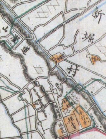
landscape as in the Edo era. In those days the foot of Fuzimizaka slope ( presently
Nezu and Sendagi area) was still mostly rural districts with farm houses standing here and
there.
From the early Taisho era to Great Kanto Earthquake of 1923, under the influence of release of residential land from the nobility propertied class (Kazoku ), a cultural town-making was done there. Nippori Watanabe town was made by Watanabe Preserve Company in Dokanyama (the present Nippori 4-choume) and many cultured persons like artists lived here. Starting from this time, the towns rising at the foot of Fuzimizaka slope such as Yanaka Hatsune-cho and Sendagi sakashita-cho were turned into residential area gradually.
After that, without seeing any big changes during the Showa mid-war
and post war period, Suwa Terrace was to reach the period of economic high growth.
|